So, I Was Going to Write About the San Antonio Museum of Art. . . .

I figure that since my last South Texas Destination, Denman Estate Park, was the home of a major donor to the San Antonio Museum of Art, I maybe should write up the museum next.

At first, I thought that I should make another trip to the museum, but I’ve been there dozens, or maybe even scores, of times over the last 23 years that I’ve lived in San Antonio, so I don’t actually need to go there again before I can write knowledgeably about it.

Then I went looking for my pictures from my last trip to the museum and couldn’t find them.

I know that my last trip to the museum was after my dad moved down here in 2009. In fact, Alex, my dad, and I went to lunch at La Gloria at the Pearl Brewery and then hiked down the Riverwalk to the museum, and the oldest Yelp review I can find for La Gloria is from 2010, so we can probably make that the earliest start date.  I think we must have gotten there after 4 p.m. on a Tuesday, because the museum has traditionally had free admission then and I don’t recall paying admission, though that’s actually immaterial.

The trip must have been before June of 2014, however, because that’s when I got my Galaxy S5 phone.  I originally thought to look at my Google Maps timeline to see if that trip is on there and found that neither the Pearl Brewery nor the museum is on my timeline.

I have opened and looked into every folder in my photos directory between those dates and had no luck.  I’ll keep digging just in case, but I think they’re gone.  It’s a pity, too, because there were some pictures that I was really proud of in there.

So it looks like I’ll have to go back to the museum after all.  I might be able to return to the Pearl and to the museum on Saturday, May 21, but the museum might be pretty crowded then and I might not be able to get any really good pictures without multiple strangers hanging around in them. Also, Alex and I are both recovering from a pretty nasty respiratory virus.  I feel a lot better, but I’m several days ahead of him and he got hit harder than I did.

Alex spends Memorial Day weekend (for those not in the United States, that’s the weekend before the final Monday of May) and nearly all of June with his dad, so this Saturday is going to be our last Saturday together until June 25. We have plans with my dad on Sunday, so that’s out.

So, it looks like if we can’t go on May 21, I won’t be writing about the museum until at least June 25 and at that point I might as well wait until Alex gets back from his dad’s and then go before noon on a Sunday or after 4 on a Tuesday when we can get in for free.

So I guess I’ll start working on a different South Texas Destination just in case.  Maybe I’ll do the Botanical Gardens.  I can find lots and lots of pictures from there (we’re members and get in for free). . . .

South Texas Destinations: Denman Estate Park, San Antonio, Texas

I think I’m done with downtown destinations (though I reserve the right to revisit downtown at any time in the future).  I should probably start to write up some of the parks that I’ve visited in the last few years.  I guess I’ll start with the park that I visited on Saturday, April 23, Denman Estate Park.

Gilbert M. Denman, Jr. was an attorney and philanthropist who lived in San Antonio.  Denman donated many Egyptian, Greek, and Roman artifacts to the San Antonio Museum of Art (review to follow).  When Denman died in 2004 at the age of 83, his only heirs were two cousins, and so the executors of his estate broke his real estate into two parcels and sold one to the City of San Antonio and the other (which contained the structures on the property) to the University of the Incarnate Word.  The 12.52 acre parcel that belongs to the city has become Denman Estate Park.

When you arrive at Denman Estate Park, the first thing you notice is Denman’s mansion.  This is now owned by the University of the Incarnate Word and you can photograph it, but it is private property and there are signs saying that trespassers will be prosecuted.

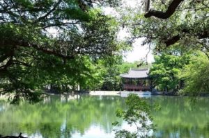
As you travel down the 0.36-mile path, there will be a labyrinth on your right-hand side.  I like to walk the labyrinth when I visit.  After the labyrinth, the path goes around a pond.  On the far side of the pond is a pavilion donated to the park by the city of Gwangju, South Korea.  The pavilion was built in Korea and then disassembled, shipped to the United States, and reassembled by the artisans who built the pavilion.  There are signs saying that people should stay off of the pavilion.  A friend who works in the construction industry says that the pavilion was built with traditional methods.  There is not a single nail in the whole thing.  This means that it is probably not going to fall down if you go up in it, but it also doesn’t comply with San Antonio municipal building codes and thus is unfit for human occupancy in the city.  Also, keeping people out of it will keep it looking as nice as it can for as long as it can.  So just admire it from the ground and don’t go up in it.

Denman Estate Park Pavilion, San Antonio
The Gwangju Pavilion from the far side of the pond, Denman Estate Park, San Antonio, Texas

There is another branch of the path that passes down through a wooded area behind the pavilion.  I think I’ve only been down that path once or twice, and it’s a very nice, shady walk.

In front of the house is a statue of a mermaid labeled “AMA MARIA ” and with a set of coordinates.  In Spanish, “Ama” is “he, she, or it loves,” so I assumed that the name is in Spanish.  It isn’t.  The statue is part of a charity art project to raise awareness of the state of the world’s oceans.  The explanation for the “AMA” name is that this is the title used for female pearl divers in Japan and Korea.  It looks like there are nine of them in existence, and the website tells how to purchase one, if you have €15,000 plus tax (and shipping if you live outside of Europe) burning a hole in your pocket.  AMA Maria belongs to the University of the Incarnate Word, but she is on the park side of the house.  I’m not sure if she’s on private property or not.

Denman Estate Park is a nice little park to visit if you happen to be in the neighborhood or if you have half an hour or so to spare.  The main path is labeled Level 1, so it is wheelchair accessible.  The path behind the pavilion is unlabeled, but it seemed to be no higher than Level 2 to me.  There are some waterfowl in the park.  The Sebastapol geese seem to be the most aggressive of them, and I’ve never had them do more than hiss at me.  If you happen to have any ornithophobes in your group, you may want to be cautious on your visit.

South Texas Destinations: Tower of the Americas, San Antonio, Texas

The 1889 World’s Fair had the Eiffel Tower.  The 1893 World’s Fair had the Ferris Wheel.  And the 1968 World’s Fair had the Tower of the Americas.

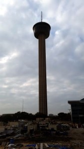
Tower of the Americas, December 25, 2015
The Tower of the Americas, getting on towards sunset, Christmas Day, 2015.

The centerpiece and theme structure of HemisFair ’68, the tower still dominates the skyline of San Antonio today.  The Tower of the Americas is known largely for four things:

  1.  Fireworks.  Traditionally, the city’s official Fourth of July and New Year’s Eve fireworks display have been set off with the Tower as a backdrop.
  2. The annual Cystic Fibrosis Foundation Lonestar Tower Climb and Run.  This is a one-mile run followed by a quick jog up the steps in the core of the Tower.  Climbing the steps of the Tower sounds like fun.  Running up the steps does not sound like fun.
  3. The rotating restaurant at the top of the Tower.  For years the restaurant was operated by the same people who run the Jim’s restaurant chain.  In 2004 the concession was taken over by Landry’s. Landry’s is a Texas chain of seafood restaurants that are nicer than casual dining, but not so fancy as what you normally think of when you think of a “fine dining” establishment.  Traditionally, my family would go to the Landry’s that used to be on Riverside Drive* when we would go up to Austin to watch the bats at the Ann Richards/Congress Avenue Bridge.  We could drop in in our jeans and t-shirts and not feel out-of-place. The Chart House Restaurant, the restaurant in the Tower, is fancy.  Lots of tourists probably drop in in their jeans and t-shirts, and I’m sure they get fine service, but if you go, you probably want to wear your nicest jeans and a polo shirt instead, perhaps.
  4. The observation deck. This is what most people go up in the tower for.  There are two levels — an interior section that had historic photographs showing what things used to look like in the direction where you are looking and an exterior level that has only plexiglass and wires separating you from the outside.  It was very windy in the exterior observation deck the day we went.

*This restaurant is, as of the time I’m writing this, a Joe’s Crab Shack.

South Texas Destinations: The Institute of Texan Cultures, San Antonio, Texas

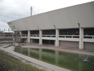
The Institute of Texan Cultures (“ITC”) is hard to really pin down simply.  The building was the Texas Pavilion in HemisFair ’68 and the ITC is now a museum dedicated to the cultural origins of  Texans, I guess?  Inside the museum, there are sections dedicated to the prehistoric peoples of Texas, the indigenous population, and many of the (largely European) nations that had immigrants to Texas (Germany has a large section which includes an entire gazebo).  There is also a display on the history of Jewish people in Texas, and an entire sharecropper’s cabin from the early 1900s.

Institute of Texan Cultures
The Institute of Texan Cultures, San Antonio, Texas, in 2014.

Outside the building is what is known as the “back forty.” This area holds a number of buildings representing different eras of Texas’s history. There’s a one-room schoolhouse, an adobe house, a “dogtrot” log cabin (that is a kind of cabin that has two separate buildings connected by a sort of breezeway), a stone building that is supposed to represent the forts of Texas, and a barn.

From what I can determine, the ITC is a pretty standard fourth-grade field trip in San Antonio.  In Texas, fourth grade is dedicated to Texas state history.  I was one of the chaperones when Alex’s fourth-grade class made the trip, so I’ve had that experience, at least.

Once you’re out of fourth grade, however, the only time most residents are likely (though not, of course, guaranteed) to return is for one of the two annual festivals held there.  The first weekend after the lunar new year is the Asian New Year festival.  City organizations representing many of the cultures of Asia that have communities here come and sell representative samples of food.  Traditionally, I get a masala dosa (from the Indian vendor), a bubble drink (from Tong’s Thai) and a kalua pork (from the Hawaiian vendor).  Martial arts and Asian dancing organizations give demonstrations and/or performances, as appropriate, and the San Antonio Bonsai Society and Ikebana San Antonio also have displays on the ground floor of the building.

The other festival is the Texas Folklife Festival, held the second weekend of June. The Texas Folklife Festival is a much bigger deal.  You can buy the t-shirts not just at the event but in stores as well. A lot of the same Asian vendors are there for the Folklife Festival, and there are a lot of other cultures represented, including a Native American booth, and a large number of European cultures (Germany, Belgium, Scotland, Ireland, and others — in past years they have had a Czech booth and a Spanish booth, but neither has been there in recent years). I at the very least have to get a Belgian waffle, though they’re just ordinary waffles and not liège waffles. But regular waffles are okay in my opinion. Sandy Oaks Olive Orchard traditionally has a vendor table, and I bought a sapling from them back in, oh, 2006 or 2007, I think.  I had my first crop of olives in 2014.  It rained too much for olives in 2015.  It may have rained enough that it won’t fruit this year, either.

All in all, though, even if you aren’t there for one of the festivals (though if you are able to be there for either one, I highly recommend going), it’s a nice little history museum and, if you didn’t attend fourth grade in San Antonio, it’s probably worth a trip.

Greenway Walk Progress

This isn’t an official South Texas Destination — yet.  But it will be eventually, so I’m categorizing it as one.

As I believe I’ve said before, my plan is to eventually visit the entire Howard W. Peak Greenway Trails System, which, since they’re still building more trails, is a pretty long-term project.  I also hope to walk the entire River Walk, but that’s a different project entirely.

I now have walked the Leon Creek Greenway almost from the Valero Trailhead at 1604 to the Leon Vista Trailhead.  I estimate that that is about 7 or 8 miles of walking.  When I say “almost,” I have missed two spots.  One, from Fox Park northwards to just north of the Northside Independent School District bus parking lot, will be pretty easy to knock out if they ever finish the construction on Hausman Road.  Just getting to the parking lot for the Fox Park Trailhead is a challenge at the moment.

The other missed section will require a chauffeur.  I walked south from the Buddy Caulk Trailhead and north from the Leon Vista Trailhead and in the time allotted to me, I missed meeting these two paths up by about two blocks.  I will need someone to drive me to the closest street to that area to drop me off, then that person will need to pick me up twenty minutes later.  This will be something that I will leave to the very end of the project.

Next up will be from the Mainland Trailhead (behind the Bandera Road Walmart) north to the Leon Vista Trailhead and then south from the Leon Vista Trailhead as far as I can go.  I don’t think I can make it all the way to the next parking lot, which looks like it’s a couple of miles away.

I’d better load more 1880s National Geographics onto my phone for this one.

South Texas Destinations: HemisFair Park, San Antonio, Texas

HemisFair Park is the site of the 1968 World’s Fair. It has pretty much been a standard park for a long time, a little bit of walking, a playground, buildings to look at, things of that nature.

The 20 houses that were saved from demolition prior to the fair are in the park, and are all currently empty.  A number of the other pavilions from the fair are also still there.  There is a playground and also part of the Mission Espada Acequia (I’m not sure if I’ve covered the acequias before.  They were irrigation ditches that started at the San Antonio River and traveled towards the missions).  My now-ex and I, on our first visit to HemisFair Park, got attacked by mosquitoes.  We’d been living in San Antonio for a few years by then and had, up until that point, never seen a single mosquito.  I guess the relative lack of mosquitoes is something to be said for living in a paved, clear-cut semi-arid place. Probably the only thing to be said for the paving, clear-cutting, and semi-aridness, but it’s something.

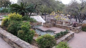
There are two water features in HemisFair park as well.  We found the first one a few years ago after the Asian New Year Festival when we took a shortcut through HemisFair Park back to our bus stop. The other we just discovered on Christmas Day of 2015.  Alex and I went downtown to see the Christmas lights and got there several hours too early.  So, we walked down to the Institute of Texan Cultures and then up through HemisFair Park.  We took a right turn when we normally make a left and discovered a beautiful fountain with water cascading down a sort of ziggurat-ish structure. We hung around there for a while, taking the path to the top and just enjoying the water.

HemisFair fountain
The top of one of the water features at HemisFair Park, Christmas Day, 2015

The Mexico Pavilion from the fair is one of the only buildings that I can find in the park that’s still open to the public.  This building is now the Mexican Cultural Institute (and it is the only national pavilion, aside from the United States Pavilion, that is still in the park).  Kitty-corner behind the Mexican Cultural Institute is the San Antonio branch of the Universidad Nacional Autónoma de México (“UNAM”).  The San Antonio campus of UNAM is primarily a language school.  I considered taking Spanish classes there at one time, but never have had the free time to do so. And if I were to do forward in my Spanish education, I would probably want to get a degree, probably a master’s degree.

There are three buildings left over from the fair which are not part of the park.  Two stand on the southern edge of the park, along César E. Chávez Boulevard.  One of these two is the John H. Wood Jr. Federal Courthouse, which originally was the Confluence Theater of the United States pavilion of the fair.  The other is now the Institute of Texan Cultures (“ITC”), which originally was the State of Texas Pavilion. The third building is the Henry B. González Convention Center.  Both the courthouse and the convention center have fallen into disrepair, which leads me to what is likely to be my final point with regard to the park.

Much of this information is soon to be out-of-date.  The city is currently overhauling the park.  There is a new convention center which, I think, is now complete. Soon the will raze the old convention center.  The city also has $135 million earmarked for a new courthouse. They will overhaul most of the park, as well. The plan is to put an apartment building in the park and there will be some retail businesses added.  I read something just today about the city wanting to put restaurants and other businesses in the empty houses in the park, and part of the population of the city is agitating to remove the ITC building and move the museum to a new location more central in the park.  The University of Texas at San Antonio, which owns the ITC, is resisting any such changes.

The ITC is surrounded by a metal fence.  I would like to see that fence done away with.  One of the big arguments of those who want to see the museum razed is that it doesn’t feel like part of the park.  Removing that damned fence would go a long way towards making the museum feel like part of the park (the other would be removing the parking lot, but in a car-centric city like San Antonio, I don’t think that will happen). I believe that the ITC is one of only three museums that I’ve been to that have fences around them. One other is the McNay Art Museum, which used to be a private home in a not-very-pedestrian-friendly area, and the other is the Vatican Museums in Italy, and it would be weird to take down the centuries-old wall there to make the museums more accessible.  I’ve been to a lot of museums mostly, but not necessarily all, in Chicago, New York City, San Antonio, and the District of Columbia. I’ve even been to the Reading Museum (because I wasn’t about to miss a chance to see England’s copy of the Bayeux Tapestry).  And people can just walk up to just about all of the ones I can think of.  Maybe I should have left this to my post on the ITC, which is scheduled for April 15, more or less, but I’m on a roll now, so I’ll just leave it.

This will probably end up being a Part 1.  Part 2 will follow in another two years or so, once they have the official opening of the renovated park.

South Texas Travel History, HemisFair 1968, San Antonio, Texas

This post is to give you some background on my next couple of downtown San Antonio destinations.  All of these, the Institute of Texan Cultures, the Tower of the Americas, and HemisFair Park, are left over from the 1968 World’s Fair, which had the title “HemisFair ’68.”  Under a principle known as “eminent domain,” the city seized the houses in and razed a residential neighborhood on the southwest side of downtown for the fair, which was a shame.  Over a hundred buildings in the neighborhood were named as historic by the San Antonio Conservation Society, but ultimately only around 20 were saved.  Those 20 houses are in the park today.

The theme of HemisFair ’68 was “The Confluence of Civilizations in the Americas,” and San Antonio chose to host the fair that year to honor the 250th anniversary of the founding of San Antonio. If a centennial is 100 years, a sesquicentennial is 150 years, a bicentennial is 200 years, is there a term for 250 years?  Let’s check Google.  Apparently 1968 was chosen in honor of the sestercentennial of the founding of San Antonio.  Or possibly the quarter-millenial, since 250 is one-fourth of 1,000.

Looking at the buildings that still stand today, it seems that HemisFair ’68 must have had an odd layout.  If you walk around HemisFair Park today, you’ll see that some of the buildings seem (to my mind) to point off in odd directions.  The park tends mostly west-to-east, or northwest to southeast, (starting at Alamo Street) but two of the pavilions, the Women’s Pavilion and the Eastman Kodak Pavilion, are off near the southern edge, with what sure looks to me like the entrances pointing southeast, away from the center of the fair.  The Universidad Nacional Autónoma de México  (“UNAM”) is tucked up in a strange place alongside the Henry B. González Convention Center with a door that faces, again, away from the center of the fairgrounds. The building that UNAM is in might not be original to the fairgrounds, though.  There’s something labeled “Amusement Area” in that spot on the map But it still seems kind of out of the way in its current location.  I wish I could find some kind of diagram of the flow of traffic or something that would indicate why these locations seemed to make some kind of sense.

Speaking of things that didn’t make much sense, there’s Beethoven Hall.  Today Beethoven Hall is home to the Magik Theatre, but originally it was the concert hall for the Beethoven Männerchor (Men’s Chorus). The planners for the fair decided that Alamo Street needed to be widened for the fair, and for some reason they decided that the best way to do this was to lop the front off of the building, then they just bricked up the hole in a way that looks very 1960s.   They could have widened the other side of the street, but the resulting street would have been curved, which the planners apparently felt would not give a good impression of the city to visitors (and north of Beethoven Hall the street curves anyhow, so I don’t know why they objected to having a curved street south of the hall).

Some of the hotels that were built for the fair are still there today. Of particular note is the Hilton Palacio del Rio hotel, which, for years, held a record for construction of 202 days. The rooms were built off-site and then lifted into place with a crane.  One of the hotels which is no longer there was the first La Quinta Inn.  If I recall, the original La Quinta is now underneath River Center Mall.

Ultimately, the fair did make a good impression on visitors, which cemented San Antonio’s reputation as a tourist destination.

I Think I’ve Talked About the Howard W. Peak Greenway Trails System Before . . .

But I think that the Howard W. Peak Greenway system may end up needing its own tag.

This is because I hope to eventually walk the entire thing.  Not at once, though that would be cool to take a few days to do.  And it would take a few days, because at the moment, the brochure (Warning! This link leads to a PDF!) says that there are currently 47 miles of trails.  My current record (since I’ve been using the pedometer on my phone) is 12 miles in one day.  So if I were able to keep that pace, it would take me, well, about four days to walk the whole thing.

Eventually, the greenway system will ring pretty much the entire city from the Medina River in the south to Leon Creek in the west, and then the Leon Creek Greenway will meet the Salado Creek Greenway up at Eisenhower Park (just south of Camp Bullis) and then the Salado Creek Greenway will go down the east side of the city.  The Riverwalk runs down the center, but it will eventually connect to the Medina River. There don’t seem to be any plans to make the Leon Creek Greenway meet the Medina River Greenway, nor the Salado Creek Greenway with the Riverwalk.  It would be fantastic if they did, though, because then one could just start anywhere in the system and reach any other part almost without ever going up to street level.

And I hope to walk all of it eventually.

So far, I’ve done the middle part of the Salado Creek Greenway, the far northern part of the Leon Creek Greenway, and, just at a rough guess, the northern 70% or so of the Riverwalk.  So I have my work (or my walking, technically) cut out for me.

South Texas Destinations: Milam Park, San Antonio, Texas

Okay, do I start with Benjamin Milam or with the cemetery?  :flips coin:

I literally did just flip a coin there, and it came up tails, so the cemetery it is.

In the 1850s, there were two graveyards in the area near the intersection of Houston and Santa Rosa Streets.  On one side of the line which is now Houston Street (underneath where the Children’s Hospital of San Antonio is today) was the Catholic cemetery.  On the other side of that line was a public cemetery for non-Catholic burials.

After only a few years, the number of dead in the public cemetery became too great for the small plot of land and all of the bodies there, except, to our knowledge, one, were moved to other cemeteries.  That one body belonged to Ben Milam.

Benjamin Rush (Ben) Milam was born in 1788.  In the early 1800s he moved to Texas and when the war for Texas Independence began, he is claimed to have called for recruits to take the town of San Antonio by calling out “Who will go with old Ben Milam into San Antonio?”  In one version of the tale, he is said to have drawn a line in the dirt on the ground with a stick in his hand.  This will be important later.

Milam was killed during the Siege of San Antonio by a gunshot to the head.  He was on his way to the “Veremendi Palace, which the house gained the title “Palace” because it had been home to one of the governors of Coahuila y Tejas.  The Veremendi Palace was on Soledad Street not too far from Main Plaza.  Milam’s body was buried in the yard of the house originally and later his body was exhumed and moved to the public cemetery.

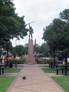
Once his body was interred in the public cemetery, a marble marker was placed over the spot.  Later that marker was removed and replaced by a granite monument, which was originally supposed to have been surmounted by a statue.  They never put the statue on the monument.  34 years after Milam’s burial, they turned the land into a park and named the park for Milam. In 1938, the Texas Centennial Commission put a statue of Ben Milam holding a rifle aloft in his right hand on the west edge of the park.  Over the intervening decades, the knowledge that the granite monument was a gravestone was lost and, in 1976, the marker was moved as part of a park beautification project.

Milam Statue, Milam Park, San Antonio
The statue of Ben Milam in Milam Park, San Antonio, Texas

In 1993, the city began renovations on the park and the workers found a skeleton under a concrete slab.  The slab was near the center of the park and was just little larger than the size of the granite monument.  Since the granite monument was heavy and had originally been planned to be even heavier, the archaeologists who were monitoring the project decided that the concrete slab may have been the original foundation for the granite monument.  If that were true, the skeleton had a good chance of being Milam’s remains.  They exhumed the body and took it to the Center for Archaeological Research at the University of Texas at San Antonio.

The remains were of a man of about Milam’s height who was about Milam’s age at death.  Only fragments of skull were found, but they had markings consistent with having been killed by a gunshot to the head.  Remember the stick in Milam’s hand up there?  In that tale, he didn’t pick it up from anywhere, it just sort of was in his hand.  The body was found to have belonged to someone with arthritis in his legs and back, and, well, a cane is, in fact, a stick that you hold in your hand.

Remember that that land was only a cemetery for a few years.  The odds of another body having been placed beneath a concrete slab the size of the grave marker for Milam during those few years are slim.  Add to that the fact that the body found was a male the same height as Milam makes the chance that it’s anyone else slimmer.  That plot of land was a cemetery decades before the era of the old west gunfight (and San Antonio hasn’t been so much “western United States” as “northern Mexico”).  Most of the bodies in the cemetery had died of things like cholera and old age.  As a result, the bullet wound to the head makes it nearly certain that the skeleton belongs to Milam.

The body was re-interred under the statue in Milam Park in 1994.

Milam Park is a nice little (emphasis on “little”) park. From what I can tell, it is around four acres in area and, in addition to Milam’s grave, has a playground, a gazebo, picnic tables, and a quarter of a mile of walking trails.  As with most other urban parks, Milam Park looks pretty wheelchair accessible.  The park is all level and paved and there are curb cuts.

Reference:

Exhumation of a Hero, Colonel Ben Milam: Milam Park Renovation, Phase I, Cynthia L. Tennis, Center for Archeological Research, University of Texas at San Antonio, 1995

South Texas Destinations: La Villita Historic Arts Village, San Antonio, Texas

The area where La Villita Historic Arts Village (“La Villita”) stands today has been occupied by humans for centuries.  Prior to the arrival of the Spaniards, that are on the shore of the San Antonio River had been home to a community of Coahuiltecan Native Americans.  Around 1722, the soldiers from the Presidio (the Presidio was where Military Plaza and the San Antonio City Hall are today) lived in huts on that site with their families.  That community was later destroyed by a flood.

Then, in the early 19th Century, a group of immigrants from Germany built more permanent structures on the site.  The Germans were followed by immigrants from Switzerland, France, and Italy.  These are the buildings that are there today.  As with so much of the historical sites of San Antonio, the buildings of La Villita fell into disrepair.  During the Great Depression, the buildings were restored to their original condition, and La Villita began its current life as an arts center.

Today, La Villita is home to shops, galleries, and restaurants.  Several festivals are held there, including the Fiesta event, A Night in Old San Antonio (popularly called by the acronym “NIOSA”). My family and I also attended the India Association of San Antonio’s annual Festival of India at La Villita in the early 2000s.  Even though this information will be outdated in a couple of months, the 2016 festival will be held on March 26.  I do not know if it will be held in La Villita again, though.

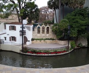
The Arneson River Theatre abuts La Villita on the San Antonio River side.  The theater is set up in an unusual but picturesque way, with the audience seating on the La Villita side and the stage on the other side of the river.

Arneson River Theatre, San Antonio
The stage of the Arneson River Theatre, San Antonio, Texas

The streets of La Villita are level, but not all of the shops are wheelchair accessible. The Arneson River Theatre has steps leading down to (or up from, depending on your perspective) the river, but I am pretty sure that there is wheelchair accessible seating at street level.